OPIE is an Earth data engine that emphasizes speed and ease of use. We transform petabytes of Earth data from sources like NASA, ESA and NOAA into usable formats. You can use this data to add Earth functionality to your app, or to develop custom Earth-aware systems for your business.
OPIE API Documentation Get your free API key
OPIE is a web service for Earth Observation data. OPIE is fast and easy to use. Use JSON calls to access Earth data from satellites.
OPIE’s backend servers collect raw scientific data from NASA and ESA satellites. This data is then processed into user-friendly types like geocoded greyscale images and CSV files. OPIE makes this data readily searchable and available.
OPIE makes scientific data usable. Our backend handles obscure scientific formats and massive data so you don’t have to.
- Talk to our servers through simple JSON calls.
- Get rich data in common formats.
- Minimize development time, maximize quality.
OPIE’s planetary dataset empowers broad insights into the Earth’s processes.
Our servers collect data from European and American public-sector satellites such as Sentinel and Landsat.
OPIE takes a multidisciplinary approach to scientific data. By applying techniques from the realm of computer graphics and video, OPIE can achieve levels of efficiency and performance which elude typical scientific data formats.
An overlay showing the presence of sea ice.
The liquid water equivalent depth of snow, measured in meters.
The temperature of water near the surface.
Two meter air temperature.
Five different gases: Nitrogen Dioxide, Formaldehyde, Carbon Monoxide, Ozone, Methane
Aerosol optical thickness. The aerosol overlay shows the total measured aerosol load of the air. This shows dust, smoke, or other particles which reduce long-distance visibility.
Prominence of plant life. The Normalized Difference Vegetation Index (NDVI). Normalized Difference Vegetation Index, or NDVI, is a measurement of vegetation prominence.
The volumetric moisture content of soil. Wetness of soil is measured as a ratio of volumes. Specifically: the volume of water in the soil divided by the volume of the soil.
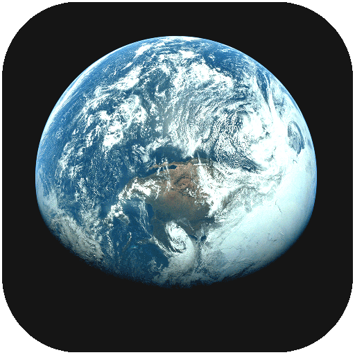
True-color images of the Earth’s surface, taken by orbiting satellites.


| Name, first (given) | |
|---|---|
| Name, last (family) | |
| Country |
